Reginald Philip Kearns (1948-2023)
National Mapping Technical Assistant 1972-1984
By Laurie McLean January 2024
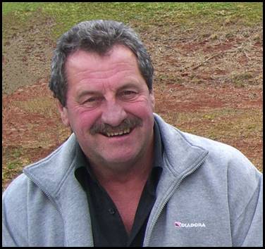
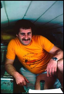
Reg Kearns at Mapleton, Queensland 25 June 2011.
Edited extract from XNatmap image by Oz Ertok (1929-2022).
Reg Kearns worked for 12 years as a Field Assistant and later as a Technical Assistant with National Mapping’s Melbourne and Dandenong offices; initially engaged on field survey projects for topographic mapping control and later on mainly office-based topographic map revision and map compilation work. Reg was a knock about sort of character who could turn his hand to many things. As a beekeeper, keen fisherman and game shooter Reg was at home in the bush. He was one of those blokes you just took to straight away. Reg made a number of life-long friends while at Nat Map. He was well respected and popular with work colleagues and a great workmate. Reg frequently used a wealth of bush sayings, such as going like the Watsons. More importantly, Reg was the loving and beloved husband, best friend, and soul mate of Jenny, his wife of over 40 years.
Early life
Reginald Philip (Reg) Kearns was born at Hamilton in south‑western Victoria on 12 February 1948. Reg was the first of the 4 children born to Philip Kearns (1917-1997) and his wife Beryl (Bobbie) Kearns née Urquhart (1927-1993). Philip Kearns and Bobby Urquhart married in Melbourne in 1947. Reg’s 3 younger sisters were Jeanette (born 1950), Robyn (born 1952), and Jill (born 1954).
Reg Kearn’s father, Philip (Phil) Kearns was born on 28 February 1917 at Dunkeld about 30 kilometres north-east of Hamilton. Phil was the sixth of the 9 children of Penshurst-born Daniel Patrick Kearns (1877-1946) and his Tooradin-born wife Annie Veronica (Cissy) Kearns née Dunbar (1884-1972). Daniel Kearns and Cissy Dunbar married at Penshurst on 15 May 1906.
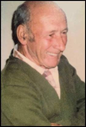
Edited image from Ancestry web site.
During his working life, Phil Kearns was a labourer, and later a builder on fencing and other projects such as shearing sheds. By the mid 1940s, Phil Kearns was also an apiarist with 100 bee hives while still undertaking other employment activities. Phil’s father Daniel and other family members also worked as apiarists. Over the years, Reg Kearns would help with the family’s apiary business.
Philip Kearns died at Hamilton on 31 August 1997, at 80 years of age. His remains were buried at the Hamilton Lawn Cemetery on 3 September 1997 in the same grave as his late wife Bobby (grave SSA Lawn 941).
Philip Kearns’ World War II service
During World War II, Philip Kearns served with the Citizen Military Forces (now known as the Army Reserve), as a Signalman, Service Number V160874. He served full time from 1943 to 1945. (His service record is erroneously listed under Phillip Kearns.) Phil Kearns had previously fractured his left thigh which left him with some movement restriction. As a consequence, he was given a Class II B Army medical rating which precluded service with the 2nd Australian Imperial Force. Prior to the War, one of Phil’s hobbies was wireless, then still an emerging technology.
Phil Kearns enlisted in the CMF at Hamilton on 26 March 1942 and commenced full time duty at Royal Park on 26 April 1943. During his Army service Phil Kearns’ postings included Hume (near Albury), Greta (NSW), Bonegilla and Portsea as well as a few other schools and training units that could not be locationally identified. Phil Kearns was discharged from the Army at Royal Park on 19 February 1945. His last posting was as a Signalman with the 2nd Armoured Regiment Signals Training Unit at Bonegilla.
Three of Phil Kearns’ brothers served with the 2nd Australian Imperial Force during World War II. Older brother Charles John Killigrew Kearns (1908‑1994) served as VX69996 Private CJ Kearns with the 2/24th Australian Infantry Battalion in the Middle East and New Guinea. Younger brother Terence Kearns (1921-1992) served as VX71635 Private T Kearns initially with the 1st Australian Vehicle Park Workshop, Australian Electrical and Mechanical Engineers and later with the 67th Australian Searchlight Workshops. He did 2 tours of duty on active service in New Guinea. Youngest brother Jack Kearns (1921-1997) served as VX147320 Gunner J Kearns with the 2/2 Australian Composite Anti Aircraft Regiment, Royal Australian Artillery and served in New Guinea.
About Reg Kearns’ mother
Reg Kearn’s mother Beryl (Bobby) Urquhart was born in Mildura on 28 August 1927. Bobby was the fifth of the 7 children of South Yarra-born Thomas Oliver (Tom) Urquhart (1891-1942) and his Dunkeld-born wife Henrietta Blanche Urquhart née Arkell (1895-1983). Tom Urquhart was a carpenter and joiner by trade and served in the ranks with the Australian Imperial Force between 1915 and 1919. As 3514 Sapper TO Urquhart, he served in France with the 15th Field Company, Royal Australian Engineers and at times had been a temporary Corporal and a temporary Sergeant. Tom Urquhart and Henrietta Arkell married at Ararat on 8 April 1922.
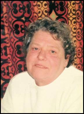
Bobbie Kearns.
Edited image from Ancestry web site.
Bobby Kearns died at Hamilton on 27 August 1993; 1 day short of her 66th birthday. Bobby’s remains were buried at the Hamilton Lawn Cemetery on 30 August 1993 (grave SSA Lawn 941).
Living at Hamilton
Reg Kearns grew up with his parents, sisters, grandparents, and other extended family members in Hamilton during the late 1940s, the 1950s, and the 1960s. In the early years, the Kearns family resided in rented premises at 25 Ballarat Road (Glenelg Highway) Hamilton (next door to the present day Sir Reginald Ansett Transport Museum).
From an early age Reg became used to knocking around the bush from helping his Grandfather, Father and Uncles tend to the family’s bee hives.
Among his many childhood memories of growing up at Hamilton, Reg once talked of going down to the coast for camping adventures on the beach during the 1950s. He recalled camping on the beach with the Bradborn family (Stella and sons Rod and Barry). The Bradborns then lived at 28 Clarendon Street Hamilton on the north side of the railway line and a few blocks north of Ballarat Road.
As a member of the Australian Regular Army, Barry Bradborn, then known as Barry Smith, served in Vietnam as a Bombardier (Service Number 3411644) with the 1st Field Regiment, Royal Regiment of Australian Artillery between September 1966 and June 1967.
In 1943, Reg’s maternal Aunty (Bobbie’s oldest sister) Jean Urquhart (1922‑1989, later Mrs John Thomas Kealy) was the bride’s attendant at Stella Elston’s wedding to Kenneth Bradborn at the Wesley Church in Hamilton.
Reg Kearns commenced his formal school education at the Gray Street State School (No 295) at the corner of Gray and Kennedy Streets in central Hamilton. After primary school, Reg attended the Hamilton Technical School in Mt Baimbridge Road Hamilton.
After leaving Technical School, Reg became an apprentice with the then Hamilton-based merchant John William (Jack) Dare (1920‑2010). (Jack Dare’s business or trading name was not discovered. However, Jack Dare was born at Yorketown, South Australia in 1920, and served with the Royal Australian Navy between 1939 and 1945, Service Number PA1560, initially as an Engine Room Artificer. He died at Horsham in 2010 at 90 years of age). While apprenticed to Jack Dare, Reg worked on a variety of farm machinery as well as on motor vehicles. At the conclusion of his apprenticeship Reg was a qualified motor mechanic.
By the late 1960s, the Kearns family resided in their own home at 111 Digby Road (the Dartmoor‑Hamilton road) on the south-western outskirts of Hamilton. The Kearns’ home was on a large town block on the south-western corner of Digby Road and Beath Street. Reg returned to Digby Road after completing National Service with the Australian Army. Initially, Reg is understood to have returned to his trade as a motor mechanic.
National Service in the Australian Army circa 1968-1970
Reg Kearns was balloted to undertake National Service in the Australian Army under a compulsory Commonwealth Government selective scheme that was introduced, under the National Service Act 1964, in November that year and operated until December 1972. The lottery type selection process was based on birth date ballots for all 19-year old males who had to register their names with the then Commonwealth Department of Labour and National Service. Those balloted in had to undertake 2 years of continuous full-time service in the Army after they turned 20‑years of age. National servicemen were liable for service in Vietnam if the Army unit they served with was deployed there. Under this scheme, 800 000 young men registered for National Service of which some 63 000 were conscripted and over 19 000 of these conscripts served in Vietnam.
After being inducted into the Army, Reg undertook 10 weeks of recruit training at the 2nd Recruit Training Battalion that was located at Puckapunyal, about 10 kilometres west of Seymour and about 95 kilometres north of central Melbourne. Afterwards, Reg undertook a period of corps training with The Royal Corps of Australian Electrical and Mechanical Engineers (RAEME) as Service Number 3794783 Craftsman RP Kearns.
Later, Reg was posted as a member of a RAEME Light Aid Detachment with the 1st Armoured Regiment, Royal Australian Armoured Corps at Puckapunyal. Here Reg helped to maintain the Regiment’s Centurion tanks and other vehicles (including Land Rovers and International trucks).
Service in Vietnam from November 1969 to August 1970
3794783 Craftsman RP Kearns, served in a RAEME Light Aid Detachment with the 1st Armoured Regiment in Vietnam from 26 November 1969 to 10 August 1970. Initially, Reg served with the B Squadron Section, 1st Armoured Regiment Light Aid Detachment.
B Squadron commenced Vietnam service in February 1969 and was relieved by A Squadron on 23 December 1969. After that relief date, Reg would have served as a member of the A Squadron Section, 1st Armoured Regiment Light Aid Detachment.
During his time in Vietnam, Reg Kearns was based with the RAEME Light Aid Detachment to 1st Armoured Regiment B and A Squadrons at the 1st Australian Task Force headquarters base at Núi Đất in Phước Tuy Province. Much of the base was in a former rubber plantation. Núi Đất was about 70 kilometres south‑east of the then South Vietnam capital Saigon (now Hồ Chi Minh City). However, Reg would have operated away from the Núi Đất base as required for military operations or other purposes.
During his service in Vietnam, Reg Kearns was granted 5 nights out of country rest and recreation leave in Hong Kong from 5 July 1970. Also during his Vietnam service, Reg was granted 3 days, in-country rest and convalescence leave at the Australian rest and convalescence centre at Vũng Tàu about 30 kilometres south-west of the 1st Australian Task Force base at Núi Đất.
The B Squadron Section, 1st Armoured Regiment Light Aid Detachment RAEME used M113A1 armoured personnel carrier-based Repair Fitters Vehicles. These vehicles were used to service and repair Centurion tanks, armoured personnel carriers and other heavy vehicles in the field and carried spare parts and tools.
The Repair Fitters Vehicles were equipped with Hydrauliska Industri AB (HIAB) cranes mounted on the left side of the hull and a counter weight on the opposite side. They were armed with a M2HB 50 calibre machine gun; see image below.
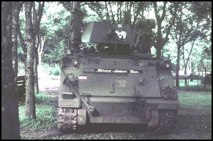
An M113A1 Repair Fitters Vehicle of B Squadron Section, 1st Armoured Regiment Light Aid Detachment RAEME at Núi Đất in March 1970.
Edited image by 3109339 Craftsman Wayne Anthony Burton (born 1947) Australian War Memorial Accession Number P05539.003.
Part of the 1st Australian Task Force base at Núi Đất circa 1969. 3793987 Private Bruce Lindsay Wilson, 85 Transport Platoon RAASC image from the Registry of Ex‑Military Land Rovers web site.
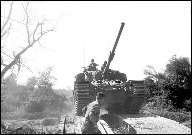
An A Squadron Centurion tank crossing a tank-layed temporary bridge in Vietnam during Operation Matilda that was conducted between 15 and 26 January 1970.
(Edited) image by 3795043 Sergeant Peter Anthony Ward (1948-2015).
Australian War Memorial Accession Number WAR/70/0063/VN.
1st Armoured Regiment in Vietnam
The first Centurion tanks of C Squadron, 1st Armoured Regiment of the Royal Australian Armoured Corps arrived in South Vietnam on 11 February 1968. C Squadron eventually comprised 26 Centurion tanks including 4 dozer-tanks and 4 bridge-layer tanks, the Squadron’s operational structure comprised a headquarters unit and 4 separate tank troops. The 50-ton British made Centurions were powered by supercharged Rolls Royce V-12 Meteor petrol engines of 27 litres displacement. The Centurions’ main armament was a 20‑pound (83.4mm calibre) gun that was mounted in a gyro‑stabilised turret and could be fired on the run.
In February 1969, C‑Squadron was relieved by B Squadron, that remained in Vietnam for the rest of that year. B Squadron was commanded by Seymour‑born 335084 Major (later Brigadier) Alexander Henry Smith (born 1934). On 23 December 1969, B Squadron was relieved by A Squadron which was commanded by Hobart-born 63503 Major (later Colonel) John Alfred Norman (Jack) Chipman (1935‑2023). In late 1970, A Squadron was relieved by C Squadron on a second tour.
Medical repatriation from Vietnam August 1970
Around 10 August 1970, Craftsman Reg Kearns was medically evacuated from Vietnam suffering from inflammation of the brain apparently from an unknown cause. Years later Reg mentioned that he received treatment for this condition after his return to Australia but thought this treatment was fairly inconclusive.
Recognition for service in Vietnam
For his National Service with the Australian Army in Vietnam, Reg Kearns was entitled to the following 6 awards: the Returned from Active Service (lapel) Badge, the Australian Active Service Medal 1945-75 with Vietnam clasp, the Vietnam Medal, the Australian Defence Medal, the Anniversary of National Service 1951-1972 Medal, and the Vietnamese Campaign Medal. (The badge and medals are shown below; the medals are displayed from left to right in the official order of wear as listed above.)
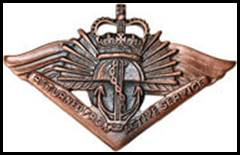
Returned from Active Service Badge.
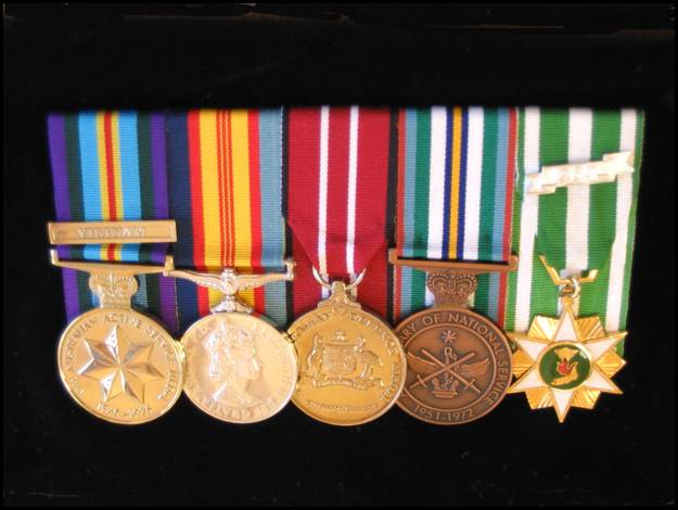
Service medals to which Reg Kearns was entitled.
Division of National Mapping 1972-1984
On 1 March 1972, Reginald Philip Kearns joined the Division of National Mapping’s Melbourne office as a temporary Field Assistant (Commonwealth Public Service 4th Division) in the Control Survey Branch, position number 27. He was to serve with Nat Map until January 1984 and during this period undertook topographic mapping surveys in the more remote parts of Australia for extended periods; particularly in the earlier years.
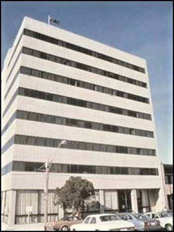
Initially, Reg was based in National Mapping’s office at the Rialto Building at 497 Collins Street Melbourne, towards the western edge of the central business district. The Gothic style Rialto and adjoining Winfield House buildings were designed by Melbourne-born architect and politician William Pitt (1855-1918) and built during 1890-1891 by contractors William Comely and Thomas Henry Gwillam (1855-1930). Both buildings were classified by the National Trust in 1973 and are now part of the Intercontinental Melbourne Hotel.
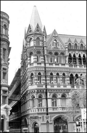
The Rialto Building at 497 Collins Street Melbourne circa 1977.
XNatmap image from Eric MacGibbon.
Reg Kearns’ known Nat Map field survey work 1972-1983
Reg Kearns’ known Nat Map field survey work is outlined below. However, please note that this outline may not be complete (particularly after 1977 when the need for extended field seasons had diminished) due to the paucity of available records and the fading of memories over the past 4 decades or so.
As well as attending to survey and general field tasks, as a qualified motor mechanic, Reg was readily able to fix Nat Map motor vehicle problems in the field, including replacing leaking oil seals and replacing broken axles.
The Aerodist years 1972-1974
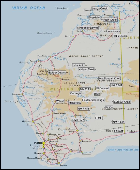
During his first 3 years with Nat Map, Reg Kearns’ field survey work involved supporting Aerodist airborne microwave distance measuring operations during the final years of this major program that established horizontal ground control for photogrammetric map compilation of the 1:100 000 scale National Topographic Map Series. Further information on the Aerodist program is provided below at Appendix A. During his 3 years of Aerodist survey work, Reg Kearns worked in all of the Aerodist survey areas in Western Australia except for Block 19 and part of Block 21 (see map at Appendix A) where measuring was completed during 1971.
During helicopter supported operations in Western Australia in 1972 and 1974, the Nat Map Aerodist measuring field parties typically comprised around 18-20 men. While the overall field party member numbers varied from time-to-time, Aerodist field staff were usually organised in the following components:
· centre party comprising the field party leader-surveyor, another surveyor, one or 2 electronics technicians, measuring aircraft pilot, and 2 or 3 other Nat Mappers
· remote transponder sub-parties comprising 4 teams each of 2 persons
· helicopter support party comprising a sub-party leader, fuel truck driver, 2 helicopter pilots and a helicopter engineer.
1972 Aerodist field survey work Western Australia
During his first field season with Nat Map in 1972, Reg Kearns spent from early March to early December away from Melbourne in Western Australia supporting Aerodist measuring surveys on the Nullarbor Plain, in the Great Victoria, Gibson, Little Sandy and Great Sandy Deserts and finally in the Central Wheatbelt to the west of Kalgoorlie.
During 1972, 517 Aerodist lines were measured and the positions of 80 survey stations were coordinated.
Initially, from late March 1972, Reg was based from the BP John Eyre roadhouse on the western fringe of the Nullarbor Plain at Caiguna on the Eyre Highway about 360 kilometres west of the South Australia border. From Caiguna, Reg and fellow Nat Mapper Michael Lloyd worked on Aerodist survey station establishment and measurement operations using a 109-inch wheelbase 4‑cylinder Land Rover van for access. Also, from mid to late November 1972, Reg again undertook vehicle-based Aerodist work on the eastern edge of the Central Wheatbelt to the west of Kalgoorlie.
However, to support the bulk of the 1972 Aerodist measuring program, 2 Hughes 500 369HS turbine engine light helicopters (VH-BLN and VH-BLO) were chartered from Jayrow Helicopters Pty Ltd based at Melbourne’s Moorabbin airport. The helicopters positioned the 2‑man Aerodist remote transponder unit survey parties on to survey control stations where ground access would otherwise have been difficult and time consuming.
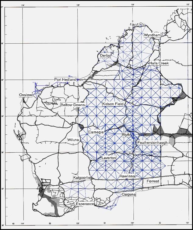
The 1972 helicopter supported measuring commenced from a base camp at survey control station R199 on about 5 May 1972 and concluded from Forrest on about 11 November 1972. The locations of the 1972 helicopter base camps (as well as the 1974 base camps in the Kimberley Region) are shown on the map below.
Nat Map Aerodist helicopter base camps in 1972 and 1974.
Base map annotated by Paul Wise.
The helicopters operated independently but usually from the same base camp. Each helicopter was required to lift a load (men and equipment) of 800 pounds (about 360 kilograms) for up to 80 nautical miles (about 150 kilometres) from base and return without refuelling. After loading the Aerodist remote equipment, 12-volt batteries and petrol engine generator, a high frequency radio transceiver, and basic camping equipment, there was little room or weight allowance left for creature comforts. No tent or chairs could be carried. Cooking equipment was a galvanised iron bucket, a saucepan, and a billy-can to boil water, the supply of which was limited to 4 gallons (about 20 litres).
With their meagre supplies and frugal outfitting, Aerodist remote party members had to endure cold and frosty winter nights and mornings as well as day time temperatures that could exceed 40 degrees Celsius. The survey control stations that the helicopter-borne remote parties occupied were at isolated places out in the bush. In the early 1970s, Aerodist survey control points were often on rocky hills or in the valleys between sand ridges. Shade from the sun was always problematic as was shelter from the wind. Fortunately, rain was rarely an issue. But the flies were! Remote party members endured this life style during the helicopter supported measuring that ran for 6 months in 1972.
Another challenge for remote party members was sheer boredom. Remote unit positioning limitations constrained the number of Aerodist lines to be measured from any given survey station during a working week. All of the other survey stations to the north, south, east and west of a given station could not be occupied at the one time. Therefore, typically no more than four or five Aerodist lines would be measured from a survey station during its occupation by any given remote party. Often it may have been fewer lines. Remote parties were often at survey stations for a few days at a time before being moved to another survey station or back to base camp, including for a Sunday rest day. Measuring of each Aerodist line took only around half an hour or so.
Mostly during the day while the aircraft was flying, remote parties would monitor the high frequency transceiver radios. By this means remote party members would be instructed when to switch on their remote units for a particular line measurement. Apart from radio monitoring, once Aerodist lines were measured for the day the only other work requirement was to ensure the two 12-volt lead acid batteries (that powered the Aerodist unit, the radio transceiver and the 12-volt camp light) were fully charged by the petrol engined Honda generator.
At night, the radio transceiver could be tuned to Radio Australia or, if lucky with radio reception conditions, to a domestic radio station for some news and music. In the Aerodist era there was no remote area television, mobile devices or video games. Helicopter loading space for books and magazines was of course limited.
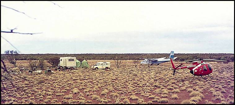
Aerodist centre party and helicopter base camp at the Blyth airstrip west of the Warburton Community Western Australia, October 1972.
XNatmap image from Oz Ertok (1929-2022).
1973 Aerodist marking and measuring in Victoria and New South Wales
Reg Kearns started his 1973 Nat Map field season establishing Aerodist ground survey marks and checking existing marks in northern and western Victoria and south-western New South Wales. During this year survey operations were vehicle-based and Reg drove a new 4-cylinder Series III Land Rover 109-inch wheelbase van. Marking operations commenced from Shepparton in late March 1973 and extended from around Wagga Wagga to Hillston and Wentworth, across central, northern and western Victoria from around Swan Hill, Mildura, Hopetoun, Ouyen, Horsham, and Hamilton and to Mount Gambier in South Australia.
Aerodist measuring operations commenced over the same area on 18 May 1973; initially with the centre party and measuring aircraft based at Deniliquin with subsequent bases at Hay, Swan Hill, Mildura and Horsham. Measuring was completed from Horsham in early August 1973. However, by then Reg Kearns and several other field party members had commenced the road journey to the next survey area on the north-west coast of Western Australia.
1973 Survey work off the Western Australian north-west coast
On Friday 27 July 1973, together with some other Nat Map survey party members, Reg Kearns departed Horsham for the 4 000 or so kilometres road trip to Port Hedland driving Series III Land Rover ZSN 169.
During August-September 1973, Nat Map survey work in the Indian Ocean off Onslow and Port Hedland in Western Australia involved measuring 57 Aerodist lines; fixing the positions of 8 offshore points by Aerodist photo trilateration; making 26 ground-based Tellurometer connections and taking 13 spot photographs of survey control stations. Some 11 survey control stations were established and the positions of 12 survey stations were coordinated by Aerodist measurements. For this survey work, the Aerodist centre party and aircraft was based mainly at Onslow (from 11 August to 20 September 1973) except during 13-17 September when the aircraft flew out of Port Hedland.
Offshore Aerodist remote and Tellurometer parties were positioned from Onslow by a chartered fishing boat, the Quinda under Master Ian (Scruffy) Blair (1929‑1998), which was chartered from 16 to 29 August 1973. In early September 1973, the survey work shifted to the further offshore Monte Bello Islands and Barrow Island area. The offshore survey parties were positioned by the chartered fishing vessel Caroline M out of Sam’s Creek near Point Samson (about 16 kilometres north of Roebourne and about 150 kilometres south-west of Port Hedland. The Caroline M departed Sam’s Creek on 4 September 1973 and returned at the end of the survey on 10 September 1973.
1973 Archipelago of the Recherché survey
The Archipelago of the Recherché is also known locally as the Bay of Isles and comprises 105 islands and over 1 200 obstacles to shipping. The Archipelago is in the Southern Ocean off the south coast of Western Australia near Esperance. The islands have been known to Europeans since the Dutch-French explorer François Thijssen and the Dutch navigator and explorer Pieter Nuyts charted the coast in 1627 when sailing on ’t Gulden Zeepaert (The Golden Seahorse). The area was named Archipelago of the Recherché (L’Archipel de la Recherché) by French Rear‑Admiral Antoine Raymond Joseph Bruni d'Entrecasteaux in 1792.
In late September 1973, Reg Kearns and other members of the Aerodist field survey party assembled at Esperance on Western Australia’s southern coast to undertake survey work over the Archipelago of the Recherché in the Southern Ocean. To position the offshore survey parties, a 30-feet long fishing vessel with a dinghy was chartered from well‑known Esperance identity Donald Hugh Ardross (Don) MacKenzie (1915-2012); the charter was from 1 October to 1 November 1973.
The 1973 Archipelago of the Recherché survey fixed control points using various methods: 13 offshore Aerodist lines were measured with the positions of 5 survey stations being fixed by these Aerodist measurements. Another 7 stations were fixed by Tellurometer radiations or by closed traverses; with a total of 12 Tellurometer lines being measured. Another control point was fixed by 3-ray theodolite intersection. Points on 8 unmarked islands and rocks were fixed by 2-ray theodolite intersections. This variety of survey methods was due to the nature of the topography and the prevailing sea and weather conditions.
In the survey area, only Daw Island and 2 other islands had sheltered landings and only Daw Island had a sandy beach. Other islands were mainly of smooth granite rock dipping sharply into the water, or with vertical cliffs or tumbled broken rocks. The waves from the open Southern Ocean continuously broke over or swept around these exposed features. The prevailing weather pattern was strong winds, rain and rough seas. Generally, fairly calm seas were only experienced on a couple of days each week. Landings on most offshore features were always problematic and hazardous. Several items of less valuable equipment were lost due to difficult landing conditions during the survey.
Reg Kearns and other survey party members drove back from Esperance to Melbourne at the end of the survey; arriving in mid-November 1973.
1974 Aerodist survey work in the Kimberley Region Western Australia
On 5 June 1974, Reg Kearns together with other Nat Map Aerodist field survey members commenced the some 6 000 kilometres road journey via Perth to Derby. The field party members arrived at Derby around 26 June 1974 to prepare for the final year of Aerodist field operations.
Initially, the field party worked on establishing 13 new Aerodist survey stations and checking and clearing existing trigonometrical stations to be occupied during Aerodist measuring. These establishment and clearing activities commenced on 27 June 1974 and continued until around 31 July when Aerodist measuring operations were first scheduled to commence. However, the start of Aerodist measuring operations was delayed for about a month owing to aircraft unavailability. During most of August 1974, many of the Aerodist survey party members were engaged on a trigonometrical station renovation project that extended over the Kimberley and as far south as the Meekatharra-Wiluna area as well as into the East Pilbara.
National Mapping Aerodist lines measured in Western Australia during 1971‑1974 and Aerodist centre party and measuring aircraft bases in 1972 and 1974.
Diagram prepared by Paul Wise.
Aerodist measuring operations eventually commenced on 2 October 1974 with the centre party based at Wyndham. The further delay was due to an engine fire onboard the Grand Commander measuring aircraft (VH-EXZ) when on the ground at the Gibb River homestead airstrip (between Derby and Wyndham) on 10 September 1974.
Helicopter support for the Aerodist operations commenced around 5 September 1974 with 2 Hughes 500 369HS helicopters (VH-BLO and VH-SFS) again chartered from Jayrow Helicopters Pty Ltd. Initially, the helicopters were used in establishing 6 of the new Aerodist stations and later on Tellurometer traversing survey work. During Aerodist measuring operations on 25 October 1974, helicopter VH-SFS lost its tail rotor when ferrying a remote party (Bob Smith and Barry Wright) from a helicopter camp at Kimberley Downs. Fortunately, the former Royal Australian Air Force pilot Victor George (Vic) Barkell (1925-1995) skilfully controlled the aircraft in an emergency descent from 5 000 feet. Although the helicopter landed heavily and was destroyed by the impact, there were no serious injuries to the 3 people who were able to walk away from the aircraft.
The final National Mapping Aerodist line was measured on 2 November 1974. It was one of the 100 Aerodist lines measured that year to coordinate the positions of 12 survey control stations. 1974 field operations were concluded at Derby on 6 November 1974 and Reg Kearns together with other field party members commenced the long road journey back to Melbourne.
1975 Airborne Laser Terrain Profiling operational support
Reg Kearns supported Nat Map’s Airborne Laser Terrain Profiling operations for part of the 1975 field measuring season. At that time, the field party also comprised party leader Surveyor Paul Wise, and Technical Officers John Ely (1939-2023), Ian Graham (1955-2009) and Ross Chisholm.
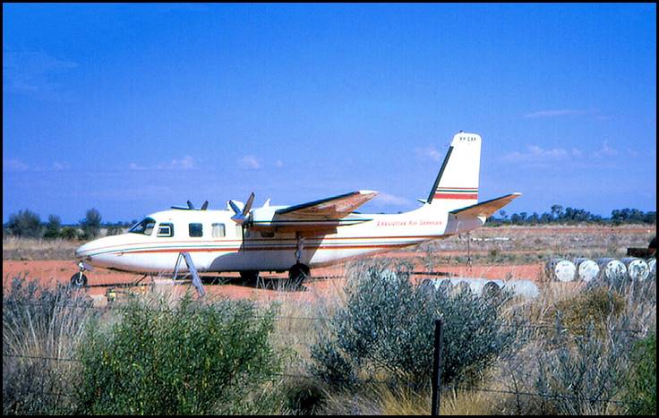
As usual, early in the field season, the laser and associated equipment was installed into the chartered measuring aircraft at the Weapons Research Establishment facility in the northern Adelaide suburb of Salisbury. (The aircraft was then a Rockwell Grand Commander 680FL (VH-EXP) on charter from Executive Air Services Pty Ltd based at Melbourne’s Essendon airport.) While the installation was taking place, Reg Kearns drove the laser mobile office‑workshop and ground power generator unit to Oodnadatta on the south‑western fringe of the Simpson Desert in South Australia, about 1 000 kilometres north-west of Adelaide. Oodnadatta was the first laser aircraft operations base in 1975.
At the time, the office-workshop was mounted on a 1968 RLCH model Bedford four-wheel-drive truck (Commonwealth registration ZSU 263). It was powered by a 4.9 litres (300 cubic inches) capacity 6-cylinder overhead valve Bedford petrol engine; see image below.
Unfortunately, Reg’s 1975 field season was cut short when he injured his right arm at Oodnadatta. Luckily, there was a nurse at Oodnadatta (but no doctor or hospital). The nurse strapped up Reg’s arm after assessing it was not broken. But owing to wet weather that closed the local roads and airstrip, Reg had to wait at Oodnadatta for a few days. He was then flown to Alice Springs in the laser aircraft (VH-EXP) and taken to the local hospital where an X-ray revealed Reg had a broken collar bone. Shortly afterwards Reg flew back to Melbourne on a commercial airline flight.
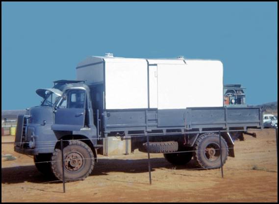
Nat Map’s mobile office-workshop and laser ground power generator unit mounted on a 1968 RLCH model Bedford 4X4 truck (ZSU 263).
XNatmap image.
1976 Weather observations Western Australia
In the second part of 1976, Nat Map commenced a high altitude mapping photography capture program using a Wild RC10 aerial survey camera fitted with an 88mm super wide angle lens. The camera was mounted in a Gates Learjet 25C (VH-TNN) chartered from Melbourne-based Stillwell Aviation. Initially, this program flew pin-point photography at about 13 700 metres above sea level so that each photo frame would cover the area of a 1:50 000 scale map sheet at a photo scale of about 1:151 000 with the flights on north-south flight lines to minimise the effect of shadow.
For the first year of this photography program, it was decided to position 2 weather observation field parties in the capture area to advise if weather conditions were unsuitable. Reg Kearns and then Trainee Technical Officer Ian Stuart Graham (1955-2009) comprised one of the 2-man weather observing parties.
Reg and Ian Graham departed Melbourne around 8 July 1976 and travelled in a 109-inch wheelbase 4-cylinder Land Rover van to the Giles Weather Station near the Rawlinson Ranges on the eastern fringe of the Gibson Desert about 130 kilometres north-west of the junction of the Western Australia, South Australia and Northern Territory borders. They were based from Giles until returning to Melbourne in late October 1976.
Permanent Appointment to Commonwealth Public Service 1976
On 28 July 1976, Reg Kearns was permanently appointed to the Commonwealth Public Service as a Technical Assistant Grade 2 in Nat Map’s then parent organisation the Department of National Resources. Fellow Field Assistant Garry Burriss who had joined Nat Map in April 1972 was also permanently appointed as a Technical Assistant Grade 2 on 28 July 1976. Both appointments were promulgated on page 48 of the Australian Government Gazette, Issue No P 3 on Friday 6 May 1977.
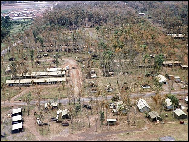
Ellery House Dandenong 1977-1984
In April 1977, Reg Kearns moved with the rest of Nat Map’s Melbourne office staff from the Rialto Building to newly-built premises at Ellery House in 280 Thomas Street Dandenong; about 30 kilometres south-east of Melbourne CBD. Ellery House was named for English-born Robert Lewis John Ellery (1827-1908) who was an astronomer and director of the Williamstown observatory for 42 years. Ellery conducted a geodetic survey of Victoria from 1858 to 1874. In 1885, he became the inaugural president of the Victorian Beekeepers’ Club.
Ellery House at 280 Thomas Street Dandenong circa 1977.
XNatmap image.
1977 Coastal aerial photography north-west Australia
During May-July 1977, Reg Kearns worked along the north-west Australian coast as a member of a Nat Map coastal aerial photography field survey party. The 1977 coastal aerial photography program was undertaken between 28 May and 15 July.
Under this program, aerial photography of the coast between Broome and Darwin was acquired at mean high water using a Wild RC9 aerial survey camera. Rocky parts of the coastline in the Kimberley region of Western Australia and further north where tidal movements are generally vertical were not photographed.
The aerial photography was acquired at an average scale of 1:34 500 on Kodak 2424 black and white 230 mm format film stock that sensed into the infra-red band of the electromagnetic spectrum. The initial field party leader was Romulus Anthony (Rom) Vassil (1930-2021) who was later replaced by Carl McMaster. Photography line navigators and Wild RC9 aerial survey camera operators included Ed Burke, Gregory Ross (Joe) McRae (1948-2021), Bob Smith and Bill Stuchbery. The RC9 aerial survey camera was mounted in a Shrike Commander 500S (VH‑PWO) chartered from Perth-based Executive Air West, and piloted initially by Jack Marshall and later by Max Cooper.
Real time tidal data was recorded at various locations in the aerial photography survey area by field parties comprising Michael Lloyd, Steve Pinwill, Robert William (Bob) Goldsworthy (1939-1985), Reg Kearns and Edward John (Ted) Rollo (1944-1997). To obtain this data they used Watts Autoset levels and graduated tide poles.
1978 Map revision aerial photography Queensland
For about 3 weeks in October 1978, Reg Kearns worked with Senior Technical Officer Ed Burke to capture supplementary aerial photography for map revision purposes in the Maryborough-Bundaberg areas of coastal Queensland to the north of Brisbane. The supplementary aerial photography was required due to significant on the ground changes that needed to be included on maps under revision. For this project, a twin-engine Cessna 310J aircraft (VH-ELX) was chartered from Omni Aviation with pilot Phil Larnach. A Nat Map Wild RC9 aerial survey camera was used for the photography capture.
Reg and Ed Burke flew from Essendon via Tamworth to Bundaberg on 6 October 1978 but had to return the next day due to a malfunction in the Wild RC9 camera. The camera was delivered to Wild in South Melbourne for repair on Monday 9 October 1978.
Reg and Nat Map Technical Officer Steve Pinwill reinstalled the camera in aircraft VH-ELX on 10 October 1978. Reg and Ed Burke returned to Bundaberg in VH-ELX with pilot Phil Larnach on 11 October 1978 and the next day conducted camera test flights over Bagara and Sandy Cape.
Supplementary photography flights were subsequently impacted by adverse weather conditions although some coverage over the Bundaberg and Maryborough area was captured on 14, 16, and 19 October 1978. Still impacted by adverse weather at Bundaberg, Ed and Reg shifted the aircraft base to MacKay on 23 October 1978. However, adverse weather persisted there. The field party and aircraft returned to Melbourne on 28 October 1978 as the aircraft was then required for another task.
1980 Map inspection Mt Isa area
From early September 1980, Reg Kearns spent a few weeks on map inspection work around the Mt Isa area of north-western Queensland. This work was undertaken by a field survey party comprising staff from Group 1 of Nat Map’s Compilation Branch. As well as Reg, the field survey party members were Surveyor Peter Quinn, and Technical Officers Ian Pasco and Norm Oliver as well as Nat Map staff Pilot Harry Baker. Reg drove a Land Rover to Mt Isa, leaving the Dandenong office ahead of other survey party members who left on 6 September 1980. Peter and Norm flew to Mt Isa by commercial airline while Ian flew with Harry in Nat Map’s Cessna 170A inspection aircraft (VH-CAS).
Marriage to Jenny McLean 1980
On 20 December 1980, Reg Kearns married Jennifer Jean (Jenny) McLean at a ceremony at their home in the eastern Melbourne suburb of Fern Tree Gully. There were no children from their marriage.
Jenny McLean was born at Sea Lake and grew up at Berriwillock. She was the fourth of the 6 children born to Berriwillock farmer Trevor John Owen McLean (1929-1991) and his wife Gladys Jean McLean née Knight (1928-1983). Jenny had an older brother, Stuart; 2 older sisters Suzane and Pauline; and 2 younger brothers, Christopher and Gregory.
Berriwillock is a small town on the Calder Highway in the Mallee region of north-west Victoria, between Bendigo and Mildura and about 330 kilometres from Melbourne. It currently has a population of about 150 people. Dating from the 1890s, Berriwillock is in a cereal and sheep farming area and is located about 20 kilometres from Sea Lake (about 500 people) to the north and about 14 kilometres from Culgoa (less than 100 people) to the south.
Jenny McLean had moved to Melbourne by the mid-1970s where she worked as a typist/clerk and later as a clerk. By 1977, Jenny was living at a unit in Kooyong Road Caulfield. Later, Jenny and Reg lived in a house at Barton Avenue Fern Tree Gully.
Reg Kearns with a Wild RC9 camera in chartered Cessna 402 aircraft (VH‑BPX) in the early 1980s, task location and other details not discovered.
Edited XNatmap image from Ed Burke.
1981 Map inspection work in the Queensland Channel Country
In September 1981, Reg Kearns was a member of a Nat Map field survey party that undertook map inspection work over 3 map sheet areas in the Channel Country of western Queensland. The map areas were Boulia, Windorah, and Winton. As well as Reg, the survey party members from Group 1 of Nat Map’s Compilation Branch were Surveyors Julie Gould and Peter Quinn, Senior Technical Officer Tom Zentai and Technical Officer Jeffrey Fox, as well as Nat Map staff Pilot Harry Baker who flew Nat Map’s Cessna 170A inspection aircraft (VH-CAS).
1983 Levelling survey Northern Territory
During August-September 1983, Reg Kearns worked on a levelling survey on the Barkly Tableland in the Northern Territory. Reg left Melbourne around early August 1983 with fellow Technical Assistant Michael Lloyd. Each drove a 6-cylinder petrol engined D1310 model 4‑wheel-drive International light truck to Mt Isa in north-western Queensland; arriving there on 12 August 1983.
At Mt Isa, Reg and Michael Lloyd met with Nat Map Dandenong Surveyor Rod Menzies and with 3 Canberra-based Nat Mappers, Polish-born Surveyor Ryszard Jan (Dick) Witrzens (1928-2009), Technical Officer Tom Mueller and Technical Assistant Maris Legzde.
The field survey party then drove about 200 kilometres or so into the Northern Territory to obtain additional vertical mapping control in an area on the Barkly Tableland to the south of the Barkly Highway. Rod Menzies, Michael Lloyd and Tom Mueller established new height control bench marks while Dick Witrzens, Reg Kearns and Maris Legzde undertook levelling surveys between existing control stations.
Reg Kearns returned to the Dandenong office on 26 September 1983. However, Michael Lloyd remained with the field party that then undertook further levelling survey work in the northern Tanami Desert to the west of Tennant Creek.
Reg Kearns’ Nat Map exit
After nearly 12 years of service to the topographic mapping of Australia, Reg Kearns resigned from the Division of National Mapping on 3 January 1984. Then Supervising Surveyor John Manning recently recalled giving Reg a formal thank-you and farewell at a send-off function in Nat Map’s Dandenong office. Reg had planned his Nat Map departure for some months and he and Jenny had purchased the Golden Crown Hotel in Berriwillock in December 1983.
Post Nat Map
At Berriwillock Victoria 1983-1989
Until 1989, Reg and Jenny Kearns owned and operated the Golden Crown Hotel in Jenny’s home town of Berriwillock which they had purchased in late 1983.
Referred to locally as the Berriwillock Hotel, the Golden Crown Hotel was built about 1896 by Messrs Fairbanks and Wilson from local limestone and bricks that were made and fired on the banks of Tyrrell Creek that runs about 8 kilometres to the east of Berriwillock. The creek has a length of about 60 kilometres and drains into Lake Tyrell that lies to the north of Sea Lake.
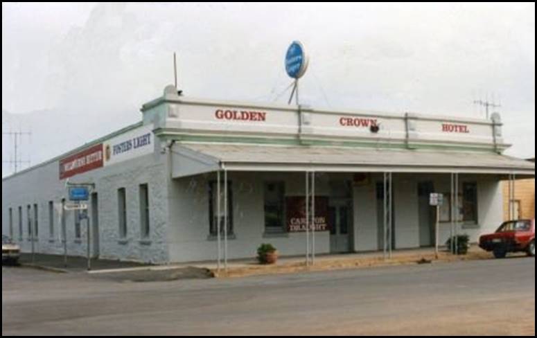
Golden Crown Hotel Berriwillock circa 2011.
Edited image from Berriwillock web site.
Farming at Compton South Australia 1989-1993
After selling their hotel at Berriwillock, Reg and Jenny Kearns moved to Compton in South Australia. Here they operated a lucerne farm. Compton is a rural locality with an area population of about 700 people and is located about 10 kilometres to the west of central Mount Gambier and about 370 kilometres south-east of Adelaide.
At Koroit Victoria from 1993
In 1993, Reg and Jenny Kearns left Compton and moved to Koroit in Victoria where they resided in North Street. The Kearns’ home is a neat double-fronted iron-roofed dwelling on a large town block. Named for the Koroitch Gundidj people, Koroit is an Irish ancestry rural village of about 1 800 people in south‑western Victoria about 270 kilometres west of Melbourne.
Surveyed and named in 1857, Koroit is located on the northern slopes of Tower Hill (about 100 metres elevation), a dormant volcano, between Warrnambool and Port Fairy and about 6 kilometres north of the coast. In 1802, Tower Hill was observed (as Peaked Hill) by the British navigator and cartographer Captain Matthew Flinders (1774‑1814). Early European settlers in the area grew cereals and potatoes and ran dairy cattle on the rich volcanic soils.
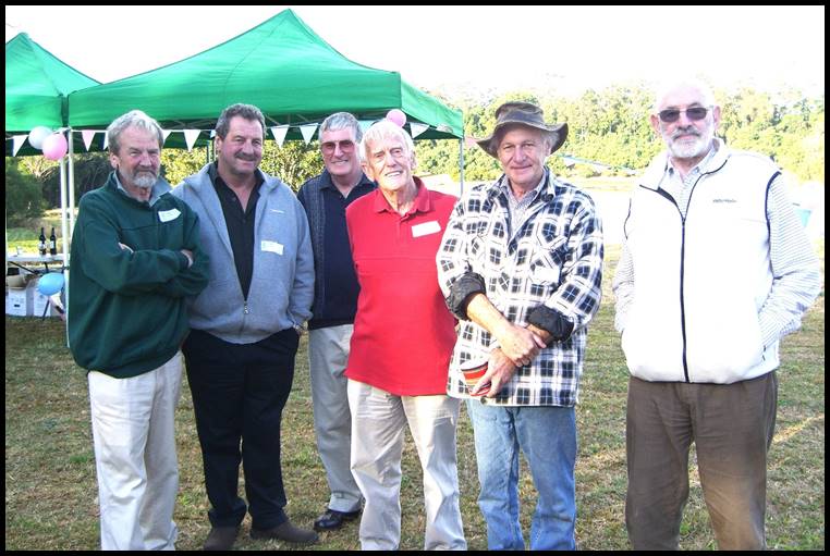
Reg Kearns with fellow Nat Mappers at Mapleton, Queensland on 25 June 2011 to celebrate Ed Burke’s 80th birthday; from left Lawrie O’Connor, Reg Kearns, Harry Baker, Ed Burke, Dave Abreu, and Syd Kirkby. Oz Ertok (1929-2022) image.
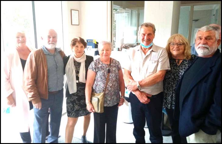
At Jenny Lloyd’s funeral service Cheltenham on 18 February 2022, from left: Margaret and Steve Pinwill, Diana Vlahovich, Joy Shiell, Reg and Jenny Kearns, and Peter Salkowski. Image supplied by Dianna Vlahovich.
Vale
Sadly, Reg Kearns died at the Warrnambool Base Hospital on 7 December 2023 at age 75 years. For a couple of years prior to his death Reg had been receiving treatment for liver cancer. Reg was survived by Jenny, his beloved wife of 43 years and by Jenny’s siblings and their family members. Reg was also survived by his younger sisters Jeanette, Robyn, and Jill and by their family members.
The funeral service for Reg Kearns was held at the Hamilton Golf Club in Rippon Road Hamilton on Thursday 14 December 2023; it commenced at 3:30 pm. After the service Reg’s remains were buried at the Hamilton Lawn Cemetery on the Henty Highway on the north-western outskirts of the city. The funeral directors were Frank Greed and Sons of Hamilton.
Over 130 people attended Reg Kearns’ funeral. Among the mourners were Nat Mappers Michael Lloyd, Peter Salkowski, Dave Goldsmith, Garry Burriss and wife Barbara, and Steve Pinwill and wife Margaret.
Reg’s National Mapping friends and work colleagues extend their sincere sympathies for their sad loss to Reg’s wife Jenny, his sisters and to his other family members and friends. Regretfully, Reg has now left us but fond memories of him remain.
Acknowledgements
During the research for and the preparation of this article the following people generously provided assistance:
· Jenny Kearns, Reg’s wife for 43 years until his death
· Harry Baker, former Nat Map Pilot and AUSLIG Chief Pilot
· Ed Burke, former Nat Map Senior Technical Officer
· Michael Lloyd, former Nat Map Technical Officer
· John Manning, former Nat Map Supervising Surveyor and Assistant Director
· Rod Menzies, former Nat Map Senior Surveyor
· Bill Stuchbery, former Nat Map Technical Officer
· Diana Vlahovich, former Nat Map Technical Officer
· Paul Wise OAM, former Nat Map Senior Surveyor and founder, operator, and editor-in-chief of the XNatmap website.
The author gratefully acknowledges the kind assistance provided by each of these people.
Clarification
Reg’s wife, Jenny Kearns (née McLean) and the author are not related.
National Mapping’s Aerodist program 1963-1974
As detailed in the text above, between 1972 and 1974, Reg Kearns worked as a Field Assistant on the final years of National Mapping’s Aerodist measuring program. In 1963, the Division of National Mapping employed Aerodist, a South African made airborne microwave electronic distance measuring technology. Aerodist was a secondary radar system. Nat Map used Aerodist on a major program to establish horizontal ground control for the photogrammetric plotting of compilation sheets in the 1:100 000 scale National Topographic Map Series. The Aerodist measuring program operated over 12 field seasons. The initial Aerodist lines were measured in Queensland’s Bowen Basin in 1963. The final Aerodist line was measured in the Kimberley region of Western Australia in early November 1974. During this program, the Aerodist system was used to measure over 3 000 survey lines that fixed the positions of some 485 survey control stations that extended over more than 50 per cent of the Australian mainland. Aerodist was also used in offshore areas in Queensland and Western Australia; see the first diagram below.
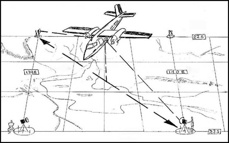
The Aerodist system allowed dynamic slope distances from 2 ground transponder (or remote) stations to be measured by the master equipment in an aircraft that would fly between the two ground stations. Typically, the Aerodist ground remote stations were established in braced quadrilaterals at 1° of latitude and longitude intersections within a surrounding geodetic survey network. Usually 8 lines were measured from each Aerodist ground station to adjoining ground stations; see second diagram below. In the more remote areas, helicopters were used to position the Aerodist remote operator parties from helicopter base camps on to the ground stations where these 2 people would camp out for most of the week.
By using these measured slope distances, as well as the known aircraft antenna separation distance, the height of the ground stations, the height of the remote instrument in relation to the ground station, the aircraft height at the line crossing point, and by taking meteorological observations to calculate atmospheric refraction, a sea level distance between the two ground stations could be determined. The slope distances between the Aerodist stations were recorded on paper charts in the measuring aircraft.
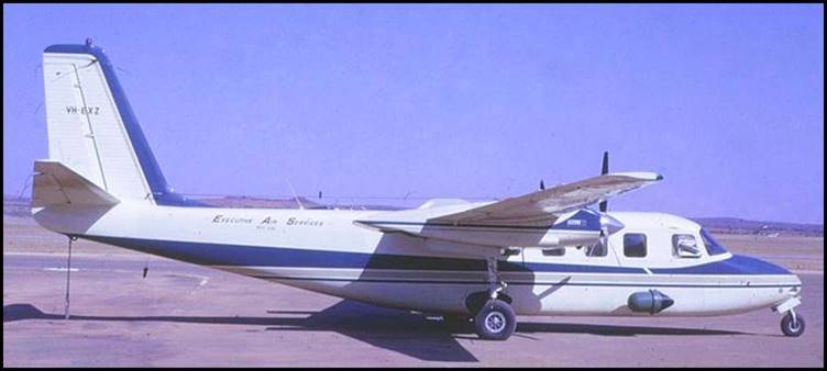
The Rockwell Grand Commander 680FL (VH-EXZ) that was used as the Aerodist measuring aircraft from 1966 to 1974.
XNatmap image.
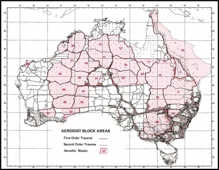
Final National Mapping Aerodist Blocks which indicate the extent of the Aerodist measuring program between 1963 and 1974.
A typical Aerodist one degree braced quadrilateral.
Diagram prepared in 1972 by helicopter pilot Harvey Lee (Harvey) Else (1928-2022).
Nat Map’s Airborne Laser Terrain Profiling operations 1970-1980
Between 1970 and 1980, National Mapping deployed its initial Airborne Laser Terrain Profiling system to provide photogrammetric vertical control for the plotting of certain map sheets (in areas of low relief) for the 1:100 000 scale National Topographic Map Series. The system was also used for special projects surveys including a micro-wave telecommunications link in North Queensland and for the Royal Australian Survey Corps in South Australia.
The system deployed on this program was known as WREMAPS 1 and was developed by the Commonwealth Government’s Weapons Research Establishment at Salisbury to the north of Adelaide to meet the Division of National Mapping’s defined operational requirements. The system comprised a laser distance measuring sub-system, a barometric reference unit to establish the height datum, a special continuous‑strip 70 mm camera to record the track flown by the laser, gyroscopes to sense the attitude of the aircraft, and associated support equipment, including a paper roll chart recorder for capturing the relevant data.
Nat Map’s Laser Terrain Profiling Rockwell Aero Commander aircraft (VH EXP) at Vaughan Springs homestead Northern Territory in 1975.
Edited XNatmap image.
Between 1970 and 1975, the laser terrain profiling system was mounted in a twin-engine, high-wing Rockwell Aero Commander 680FL aircraft (VH‑EXP) chartered from Executive Air Services Pty Ltd based at Melbourne’s Essendon airport. There was no measuring in 1976 as an aircraft change and related modifications were carried out. From 1977 to 1980, the system was mounted in Nat Map’s own aircraft, a turboprop, twin-engine, high-wing Nomad N22B‑25 (VH‑DNM).
During its decade of operation, National Mapping’s WREMAPS 1 Airborne Laser Terrain Profiling system was used to fly over 250 000 kilometres of laser terrain profiles. Over 100 000 vertical control height points were manually extracted from these profiles. These height points were used as the vertical control for the photogrammetric plotting of some 2.7 million square kilometres of map coverage in the National Topographic Map Series which at a scale of 1:100 000 depicted contours at 20-metre vertical intervals. This mapping coverage was over about 35 per cent of the Australian mainland, as shown on the map below.
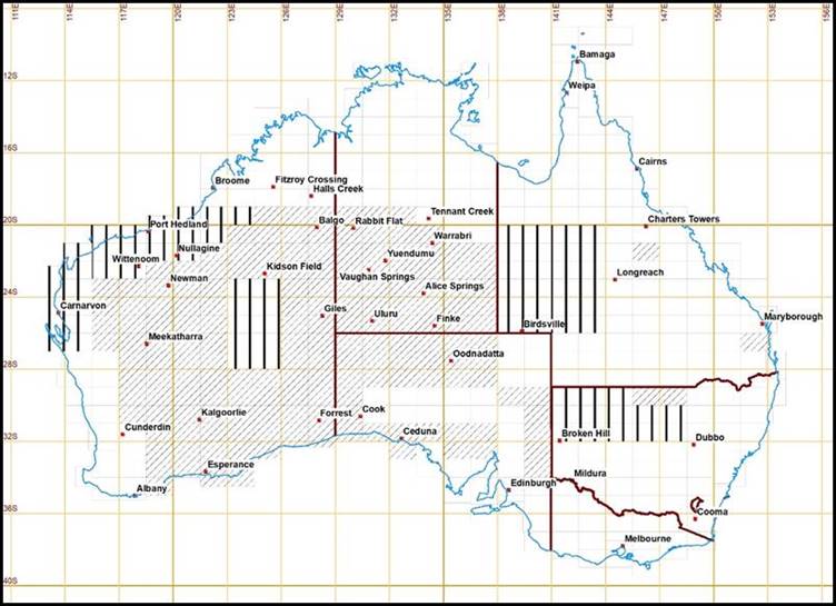
Aircraft bases used for laser terrain profiling operations between 1970 and 1980 and area covered by Nat Map’s laser profiling.
Diagonal shading depicts map sheets with standard east‑west terrain profiles and vertical stripes depict map sheets with non‑standard north-south profiling.
Map annotated by Paul Wise.